


Kaarta Contour: A Handheld Lidar Scanner That Maps Spaces in Real-Time
The Kaarta Contour is a groundbreaking handheld scanner that utilizes lidar technology to create real-time 3D maps of spaces. This device features a 7-inch touchscreen display and two handles, with a circular lidar scanner extending from the front. As you move, the scanner captures data and generates a 3D map of the environment on the screen, resembling a bird’s-eye view infrared image.
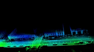
The Contour is designed for professionals working in fields like architecture, engineering, and construction, offering a convenient and efficient way to map spaces. Its real-time mapping capability eliminates the need for post-processing, allowing users to see a live map of the environment as they move through it.
Kaarta, the company behind the Contour, has its roots in Carnegie Mellon University’s Robotics School, leveraging their expertise in simultaneous localization and mapping (SLAM) technology. This technology addresses the fundamental questions of “where am I” and “what’s around me,” essential for mobile robots and autonomous vehicles.

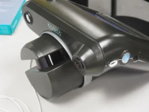
Kaarta’s technology has already gained recognition, winning Microsoft’s Indoor Mapping Competition twice and being selected by the City of Pittsburgh to map its infrastructure. The company envisions wider applications for the Contour in various fields, including first responders, hazmat teams, law enforcement, and autonomous vehicles.
The Contour, announced in April 2017, is a promising advancement in 3D mapping technology, bringing efficiency and accuracy to a range of industries.